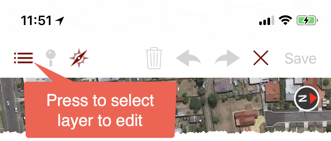
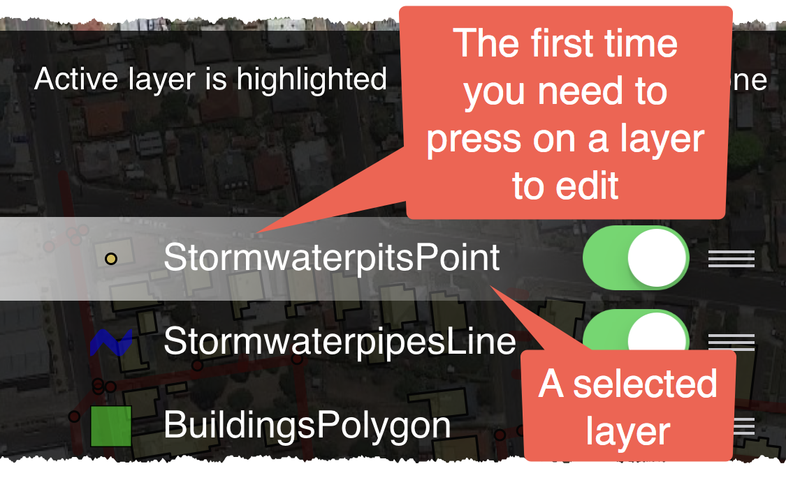
Getting Started: Capturing data with iGIS
The following screenshots show how to capture data using iGIS. The example below uses the sample “Glenorchy City Council” project.
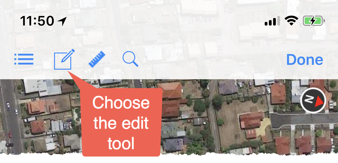
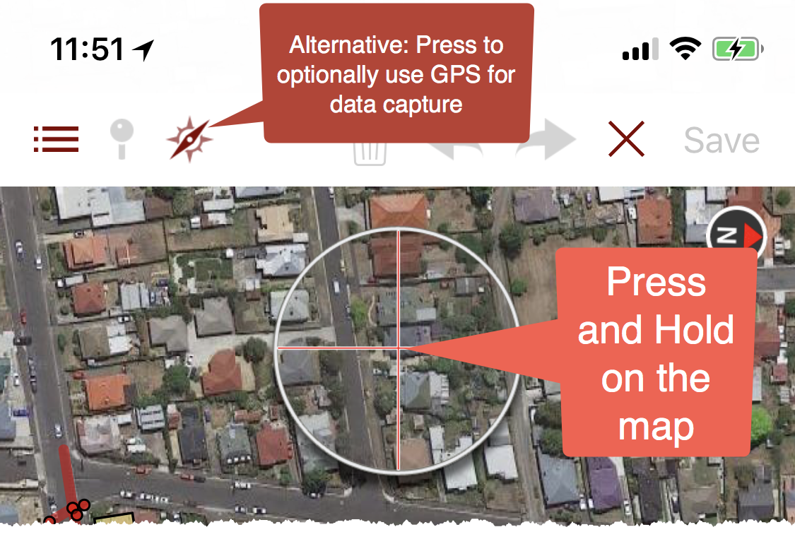
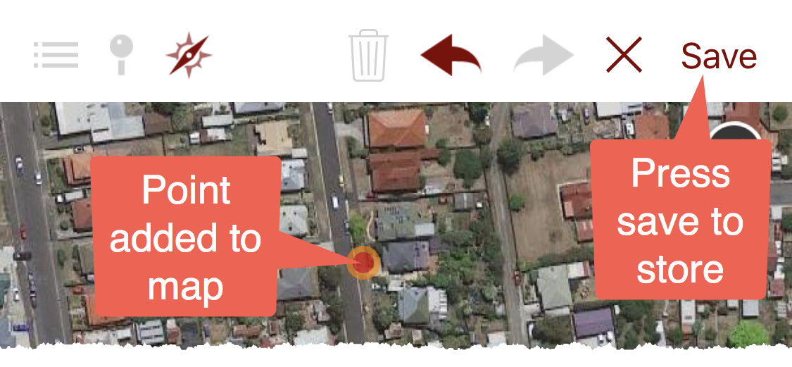
You can press and hold on the map to add points manually or alternatively you can use the GPS to capture points. This example uses the manual method.